About the Project
I developed this app in the aftermath of the pandemic when many people (myself included) found substantial mental health benefits from getting outside, and taking a walk. My goal was to give users an easy, centralized place to plan activities and explore areas they have grown too familiar with.
I developed this app in the aftermath of the pandemic when many people (myself included) found substantial mental health benefits from getting outside, and taking a walk. My goal was to give users an easy, centralized place to plan activities and explore areas they have grown too familiar with.
Tools: Adobe XD, Adobe Photoshop
Key Ideas: User Customization, Friendly Design, Local Tourism
Research
The most fruitful research technique I used were contextual inquiries— where I asked people from my target age range about their typical planning habits, and observed them as they navigated through a map application.
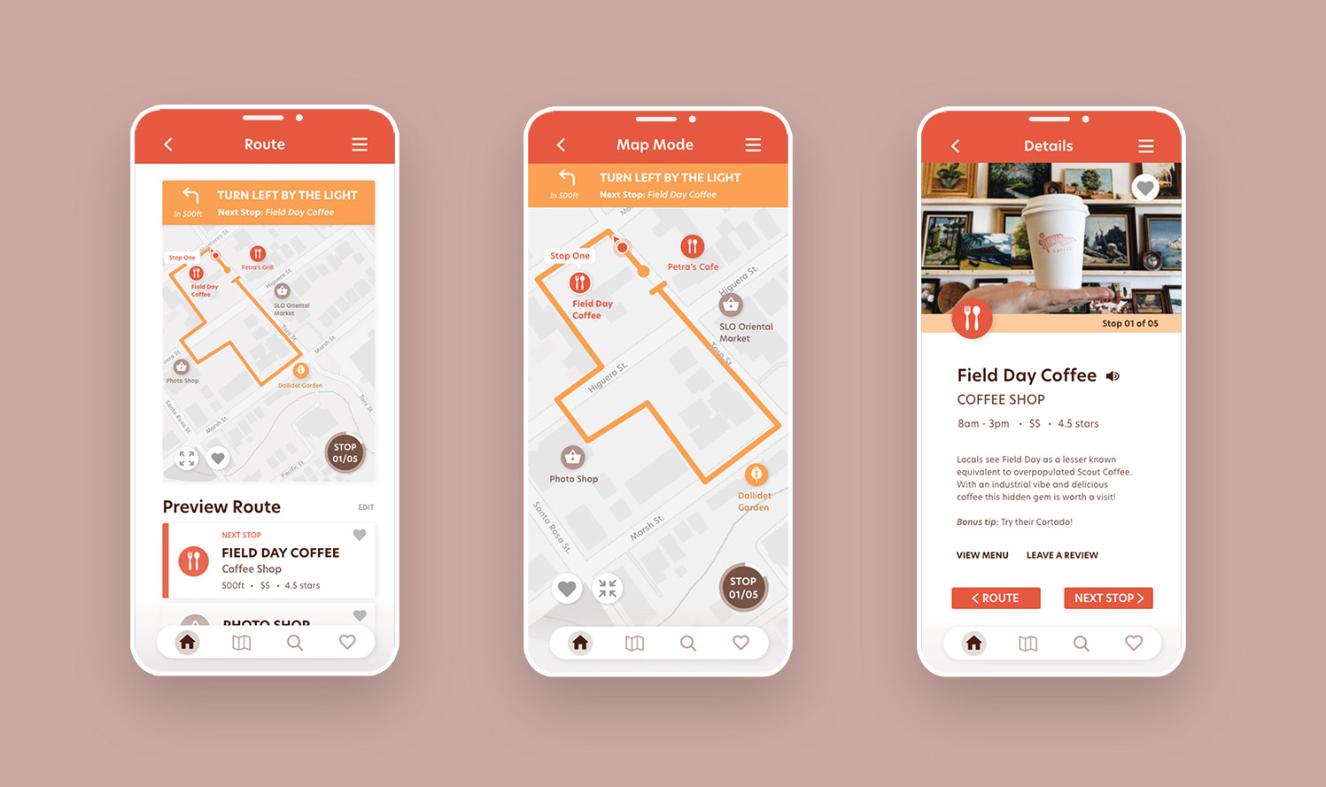
These tests led me to include more visual queues on the route map, as both users indicated that they preferred visual instructions over written.
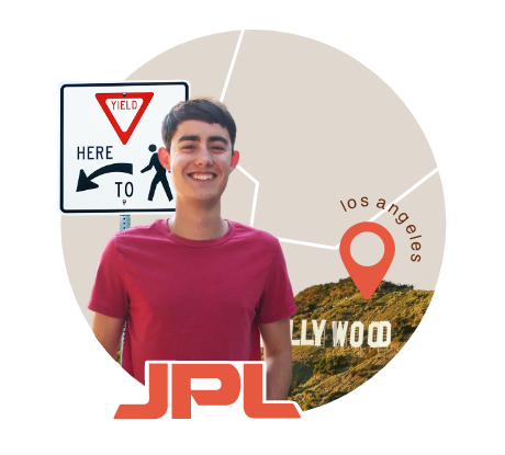
“It’s worth researching before going out,
or you might end up not having a good time.”
or you might end up not having a good time.”
— Joshua Anderson, Flight Software Engineer, Aged 22
Main Task: Discover new activities in his area that don’t require sitting in traffic.
Feels: Fed up with traffic; frustrated with the inefficiency of planning with multiple sites: eager to explore his area.
Findings:
Visits multiple sites while planning; to find what to do, how to get there, where to park, and other necessities in the area (i.e. food).
Uses the actual map rather than listed directions to navigate.
Knows his direct area well because the pandemic and remote working led him to go for more walks, but beyond the direct area, doesn’t know all that much.
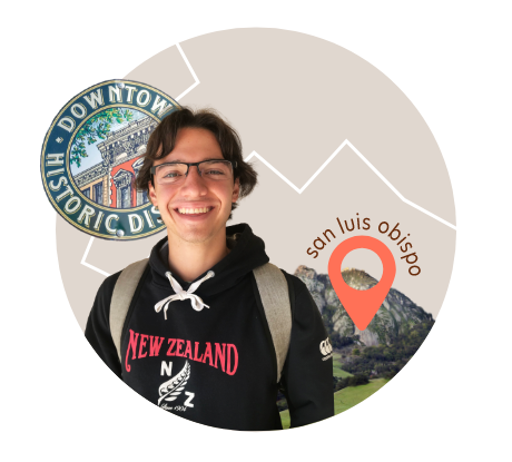
“There’s so much out there in the world,
I want to experience as much as I can.”
I want to experience as much as I can.”
— Alec Muise, Cal Poly Physics Major, Aged 21
Main Task: Find activities in his area to do with friends.
Feels: Doubtful that there are things he doesn’t know about; bored with activities he has done repeatedly; eager for new experiences.
Findings:
Uses maps services themselves to find things to do, by zooming in on different areas.
Uses maps services themselves to find things to do, by zooming in on different areas.
Needs to take into account how he will get to activities and how long getting there will take because he doesn’t have a car in the area.
Likes to try out new activities by himself to make sure they are good enough to recommend when planning with friends.
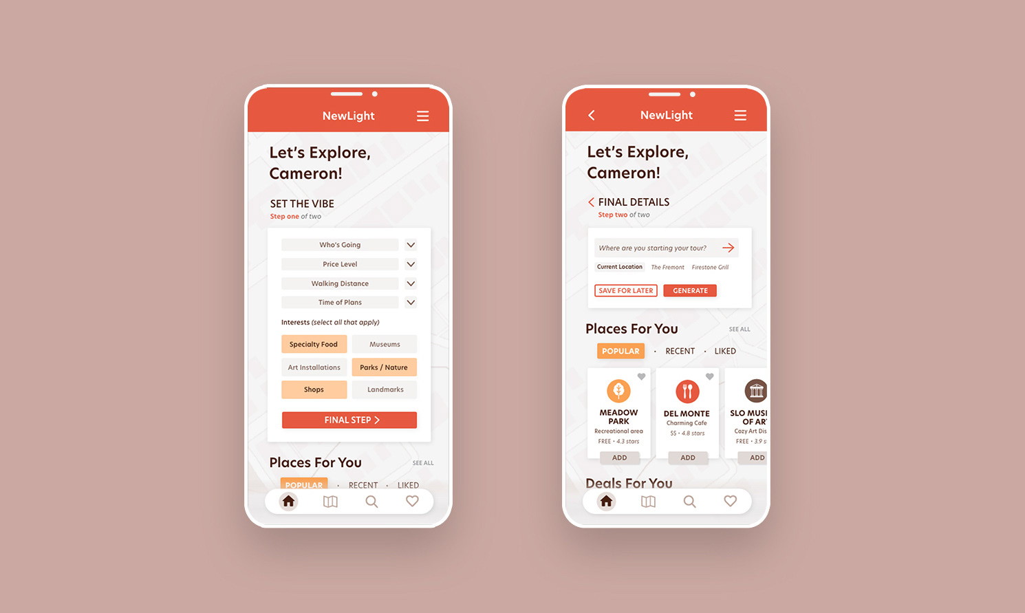
Final Design
Some of the key features of the app include a highly customizable route generation survey, a route map with area specific visual landmarks to help direct users, and screens providing details about each stop on the users route.
Some of the key features of the app include a highly customizable route generation survey, a route map with area specific visual landmarks to help direct users, and screens providing details about each stop on the users route.
With each screen, or, step of the task, I created features to accommodate the needs of different users, such as the spontaneous on-the-fly users vs. the plan-ahead / save-for-later users.